

Integrating Powerful Map Capabilities into Your Subsurface Web Applications
Map-based search is an integral part of subsurface data visualization. In order to meet usability expectations, developers of subsurface applications in the cloud must add powerful map and map-based search functionalities. The GeoToolkit map widget simplifies the process, allowing users to get quick and clear insights using common web mapping services.
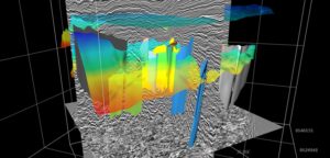
INT Adds Client SDK and Improves Seismic and Subsurface Visualization Performance with Latest Release of IVAAP 2.6
This release confirms IVAAP as a leader in the subsurface data visualization space, supporting Data Visualization and Data Management for Subsurface, Exploration, Drilling, or Production […]
Weatherford, INT Expand Collaboration to Create 2D, 3D Real-Time Well Visualization
Weatherford International plc (OTC Pink: WFTLF) announced a strengthened collaboration with upstream data visualization provider INT to provide next-level, real-time well visualization in both 2D and 3D. Weatherford will embed INT’s IVAAP framework into the Weatherford Centro™ digital well delivery software, advancing its data visualization capabilities.

Jumpstart the Development of Your Next Cloud Application with GeoToolkit.JS and INTGeoServer
INT has been a long-time pioneer by providing JavaScript components that empower developers to build geoscience applications that run in a browser. The GeoToolkit.JS libraries cut years of development time for any company creating a new application or replacing a legacy system. However, the added value of this kind of application is not just in accessing and visualizing geoscience data, it’s also in the integration of the company’s knowledge within this application.