• Skip to main content
  • Skip to footer

INT

Empowering Visualization

COMMUNITY BLOG
CONTACT US SUPPORT
MENUMENU
  • Solutions
    • Overview
    • Real-Time Visualization
    • Visualization Components
    • New Energy Visualization
    • OSDU Visualization
    • Machine Learning
    • Developer Tools
    • Cloud Partners
  • Products
    • IVAAP™
          • SOLUTIONS

            Real-Time Visualization

            OSDU Visualization

            Visualization Components

            New Energy Visualization

            Upstream Data Visualization

          • SUCCESS STORIES

            WEATHERFORD
            Well delivery optimization software

            BARDASZ
            Data management, data quality monitoring

            ANPG / SATEC-MIAPIA
            Virtual data room

            MAILLANCE
            High-performance visualization of ML algorithms

            SEE ALL >

          • SUPPORT

            DEVELOPER COMMUNITY
            Join or log in to the INT Developer Community.

            GET SUPPORT
            Log a ticket for an issue or bug.

            CONTACT US

          • DEMOS

            IVAAP DEMOS
            Cloud-Based Demos

            FIRST TIME HERE?
            Register to access our
            IVAAP demos

    • GeoToolkit™
          • SUCCESS STORIES

            CAYROS
            Field development planning

            TOTALENERGIES
            High-performance large dataset reservoir rendering

            IFP ENERGIES NOUVELLES
            Seismic and structural interpretation validation

            SEE ALL >

          • SUPPORT

            DEVELOPER COMMUNITY
            Join or log in to the INT Developer Community.

            GET SUPPORT
            Log a ticket for an issue or bug.

            CONTACT US

          • DEMOS

            GEOTOOLKIT DEMOS
            Geoscience Demos

    • INTViewer™
          • SUCCESS STORIES

            STRYDE
            Fast seismic QA/QC in the field

            SILVERTHORNE SEISMIC
            Efficient 2D/3D seismic data delivery

            WIRELESS SEISMIC
            Drones, IoT, and Advanced Onsite Seismic Data Validation

            SEE ALL >

          • SUPPORT

            GET SUPPORT
            Log a ticket for an issue or bug.

            CONTACT US

          • PLUG-INS

            EXTEND INTVIEWER
            More than 65 plugins available

  • Demos
    • GeoToolkit Demos
    • IVAAP Demos
  • Success Stories
  • Resources
    • Blog
    • Developer Community
    • FAQ
    • INT Resources Library
  • About
    • Overview
    • News
    • Events
    • Careers
    • Meet Our Team
    • About INT

arcgis

Dec 02 2020

IVAAP Release 2.7: More Map Search and ArcGIS Features

IVAAP™ is a subsurface data visualization platform that provides developers and product owners powerful subsurface visualization features for their digital solutions in the cloud. IVAAP enables users to search, access, display, and analyze 2D/3D G&G and petrophysical data in a single user-friendly dashboard on the web. The latest release of IVAAP 2.7 comes with various new features and significant improvements.

Highlights from this release include many advanced search and map capabilities, improved 3D widget filter dialog, new interval curves support, new date/time picker for Cross-Plot widget axis settings, and more! 

Advanced Mapping Capabilities

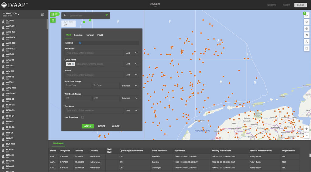
IVAAP features support for visual-based data discovery using map-based search, and is fully integrated with ArcGIS (ESRI), allowing for the search of structured and unstructured data in a data lake or any other file repository. IVAAP supports a wide range of map formats and services like ArcGIS, GeoJSON, KML, Mapbox, Bing, WMS, and more.

With the ArcGIS integration, you can easily access all layers and details from your ArcGIS server and display them within IVAAP to enrich map-based search of well, seismic, and other subsurface data.

New features include the ability to display a dynamic metadata table for a selected object in the map (Well, Seismic, etc.). 

Most layers are supported. Image services (ArcGIS Image Service Layer, Image Services Vector Layers, and WMS) and Tile services (Image Service, ArcGIS Tiled Map Service Layer, Web Tiled Layer, OpenStreetMap) are supported. Feature Services include map service (ArcGIS Feature Layer), KML, WFS, and CSV. We also provide some real-time services support like stream services (ArcGIS Stream Layer), GeoRSS, Vector Tiles (VectorTileLayer), and Bing Maps services. Two extra formats that are supported are GeoJSON and GPX.

This release includes improved search capabilities allowing search across any metadata for any user. Access to data can be restricted to read-only mode. We also made improvements to fence highlighting and access to well lists, and labels can now be saved with the dashboard.


2_7_0_Map Reduced


More Themes Control 

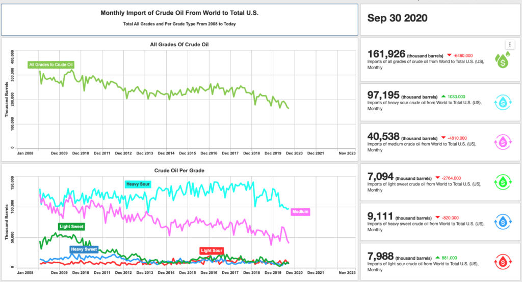
Previously, theme control within IVAAP was a bit limited. We’ve expanded the theme mechanism to all widgets so that users can customize themes with more control and options and access new updated themes.
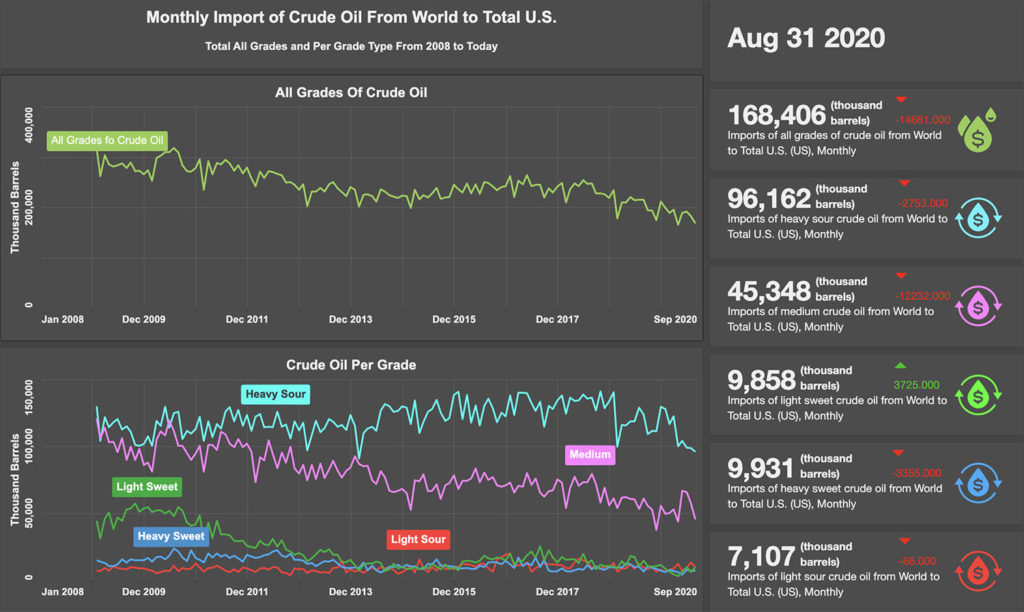
 

2_7_0_Customized Themes

Lightmode theme


New Image Widget 

IVAAP can now display simple image files such as jpeg or png files in the image widget, align, and zoom in to show detail. This feature allows users to customize dashboards with logos or other image files needed to display. 

Improvements in 3D

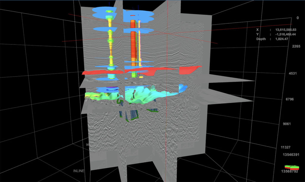
IVAAP’s 3D widget now supports tagging and aliases when displaying well data. We added reservoir data that can be serialized in the dashboard template. Users now have the ability to mix data with CRS and data without CRS. Another new feature is that users can apply properties to multiple or individual objects. And we’ve improved the dashboard restoration of multiple inlines, crossbones, and time slices. Finally, the 3D widget filter dialog has been redesigned.


2_7_0_3D Reduced


New Features in WellLog

For WellLog, we improved the set main index support for templates, dashboards, and well switching. With this improvement, a secondary index can be used to display data into a different index and secondary indexes can be restored when opening an existing dashboard or template. An improved automatic logarithmic mode gives users the ability to add a curve to a logarithmic track. New features added to WellLog include: the ability to automatically rotate labels for lithology and a reset action where users can right-click with the option to clear their display.


WellLog


New in Schematics

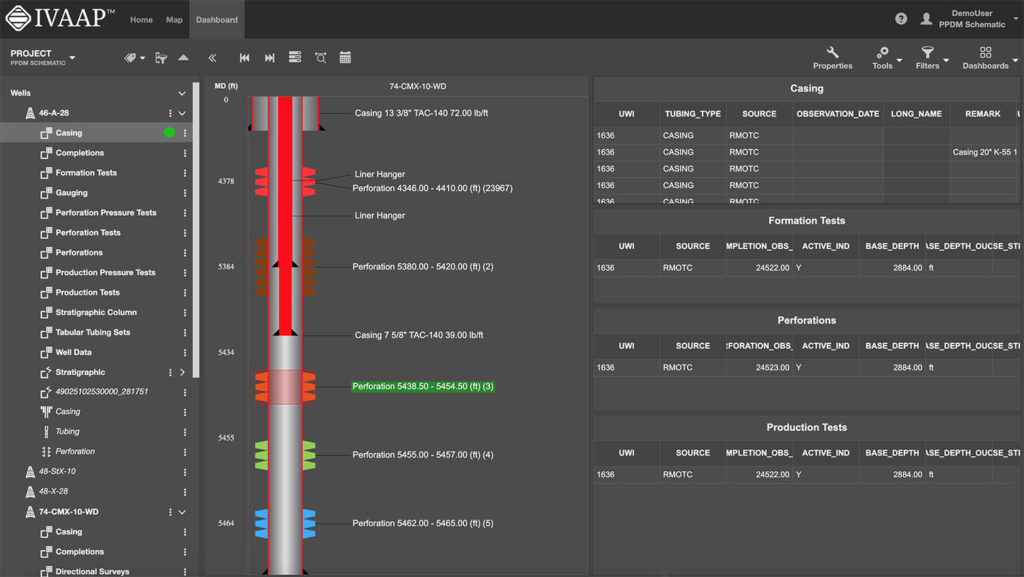
For the Schematics package, new features include: perforation with state definition support, the ability to customize by using a filter dialog, and the ability to use cursor tracking between Schematics and WellLog. We also improved the component selection support in the Schematics widget.


schematics 2.7


Time Series: Annotations and Perforations 

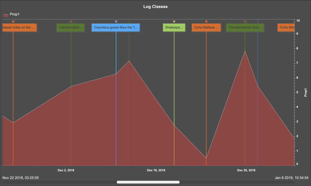
We improved the ability to select a data series from the legend. The Time Series widget now features support for annotations and perforations. The tooltip now shows the index data and time.


TimeSeries


New and Improved Line Chart

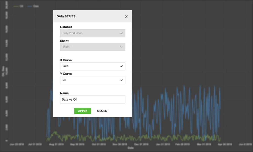
The IVAAP line chart now supports templates and data series dialog. We improved the ability to edit existing data series. Users can now flip the axis for date and time data, and the legend has been improved to show or hide the data series parent. There is also an improvement for single data sets, multi-data sets, and multi parent projects. 


LineChart


This release includes many more improvements to features and to the UI. For more information, check out the full release here.

Or check out int.com/ivaap for a preview of IVAAP or for more information about INT’s other data visualization products, please visit int.flywheelstaging.com or contact us at intinfo@int.com.
Filed Under: IVAAP, Uncategorized Tagged With: 3D, annotations, arcgis, CRS, ivaap, line chart, mapping, schematics, time series, welllog

Sep 15 2020

Integrating Powerful Map Capabilities into Your Subsurface Web Applications

Map-based search is an integral part of subsurface data visualization. In order to meet usability expectations, developers of subsurface applications in the cloud must add powerful map and map-based search functionalities.

The GeoToolkit map widget simplifies the process, allowing users to get quick and clear insights using common web mapping services. In this blog post, we will cover how to access the map widget in GeoToolkit, how to integrate other Web Services, including ArcGIS, ESRI REST, OpenStreetMap, Google, Microsoft, etc., and more about GeoToolkit’s features, including layering, labeling, symbols, annotations, and more.

map4-web

Features

With GeoToolkit.JS, there are many general functionalities that you can use in your web application. The map, which is based on the Core toolkit, provides two different versions of libraries: it has ECMAScript 6 or if you’re going for a more classical approach, ECMAScript 5. It can be used in part with different UI frameworks like React, Angular, or VUE. Moreover, it has user-friendly functionalities like symbol aggregation, label collision, export to PDF, and imaging formats.

There are also different functionalities that can be available such as axes, titles, and scrollbars. The predefined interaction tools allow you to display crosshair, panning tools, zoom to measure distance, tooltip, rubberband, and more. GeoToolkit.JS map supports a wide range of map formats and services like ArcGIS, GeoJSON, KML, Mapbox, Bing, and so on. It is also compatible with other GeoToolkitJS elements like charts, shapes, and widgets.

Getting Started

import {Map} from '@int/geotoolkit/map/Map';
import {Plot} from '@int/geotoolkit/plot/Plot';
import {Tile} from '@int/geotoolkit/map/layers/Tile';
const map = new Map();
map.addLayer(new Tile({
 'name': 'OpenStreetMap',
 'url': https://demo.int.com/osm_tiles/{z}/{x}/{y}.png
}))
const plot = new Plot({
  'canvaselement': canvas,
  'root': map
});


map3-web


  1. Create a map widget.
  2. Connect DOM canvas with the widget by creating a Plot done like other widgets.
  3. Add a layer (or layers) of interest to the widget.

Web Services: ESRI REST, OpenStreetMap, Google, Microsoft

It is important to consider which types of services can be supported since all of your data is received from different types of servers. Some services hosted include: ESRI Rest, ArcGIS, OpenStreetMap, Google Map, Microsoft, etc.

The ArcGIS Web Map protocol which is used by ArcGIS online is an easy and convenient way to build your map application. You can go to ArcGIS online, create your content, put necessary layers, combine them together, provide the link to our map widget and it will automatically be recognized. Most layers are supported. Image services (ArcGIS Image Service Layer, Image Services Vector Layers, and WMS) and Tile services (Image Service, ArcGIS Tiled Map Service Layer, Web Tiled Layer, OpenStreetMap) are supported. Feature Services include map service (ArcGIS Feature Layer), KML, WFS, and CSV. We also provide some real-time services support like stream services (ArcGIS Stream Layer), GeoRSS, Vector Tiles (VectorTileLayer), and Bing Maps services. Two extra formats that are supported are GeoJSON and GPX.

Map Services

Services cannot be used without visualization. Our part in maps products is to provide visualization for these services. To start visualization, you need to create your map widget and specify different properties. One example of a system is CRS, which is a common coordinate system of displayed data. You can specify map limits if you want to limit the visualization area of interest. You can also set different adornments to your maps like map scale. Zoom settings include min/max with a range of scales available and time/speed to customize the map management to your convenience.

Map Layers

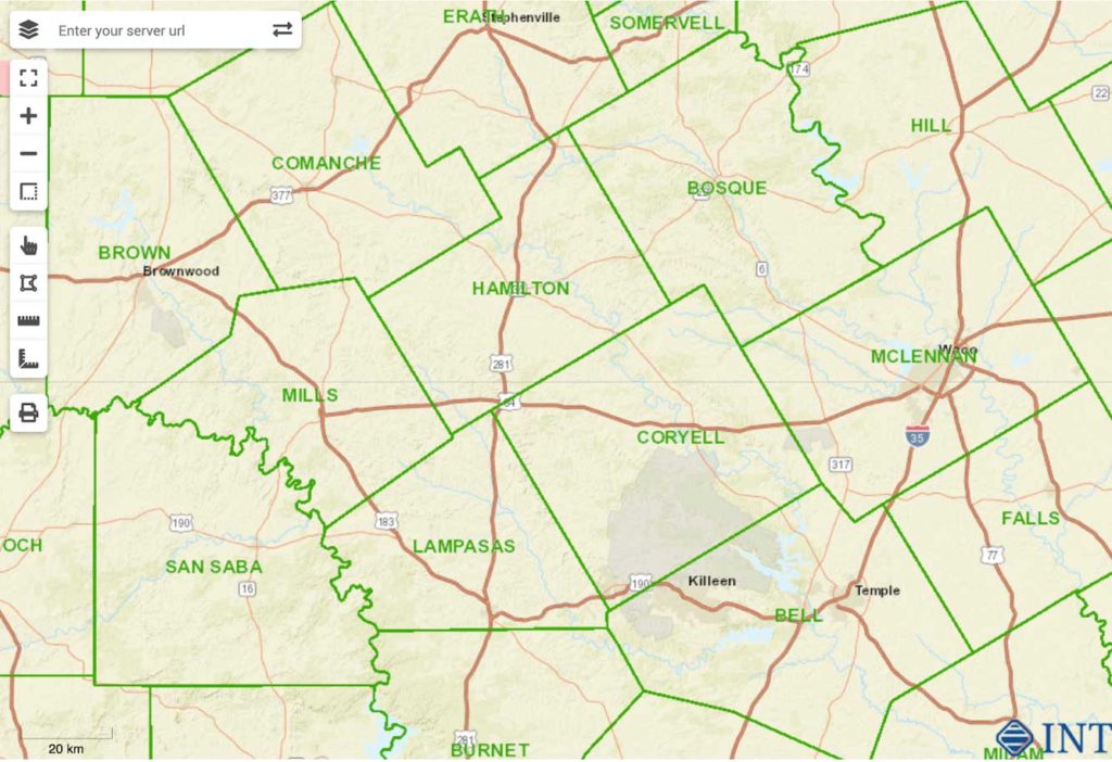
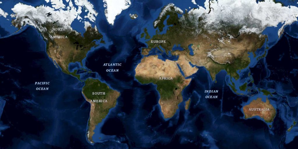
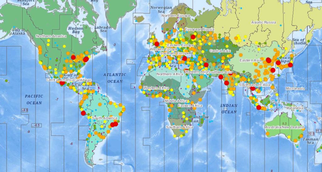
There are four main types of layers supported:

  • Image type that displays a single image received from a server. For example, WMS for Web Maps Services and ArcGISImage supports ArcGIS MapServer and ImageServer services.
  • With Tile layers, the data consists of several images (tiles) painted next to each other and thus forming a complete picture. Tile can be used as a universal layer for any tile service. Bing can be used for all Microsoft Bing Services.
  • Vector layers draw not pictures but vector data (called “features”): points, polygons, and polylines, which depict cities, rivers, islands, and more. Support of different formats includes: GeoJSON, KML, CSV, GeoRSS, Lerc translate their format into the map objects, the ArcGISFeature supports ARCGIS FeatureServer services., WFS for Web Feature Services, and VectorTile.
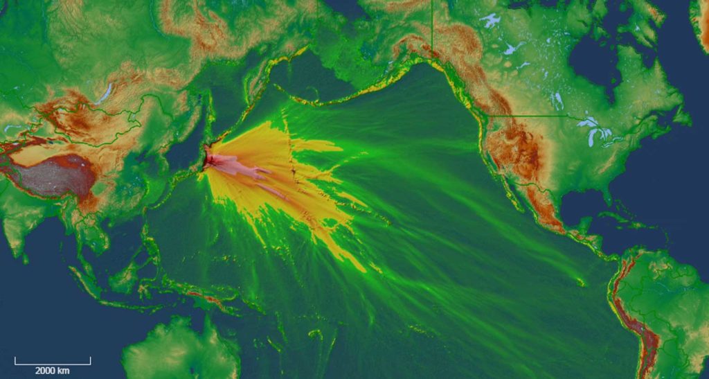
  • Shape layer is used for compatibility with other GeoToolkitJS elements to display on the map charts, contours, and other complex shapes (or just trivial ones).

Layer Settings

General setting for layers include url to the server or file, data coordinate system (epsg codes are supported), alpha as the value of the layer transparency, layerfilter for setting visibility conditions, tooltip.visible to enable tooltip support by the layer, and tooltip.formatter to generate information (in HTML format) of the tooltip content (can be used in both the basic GeoToolkitJS formatters or a custom one).


Examples of different layers:

map2-web

tsunami-web

map-web

Geo-Reference Images

Geotoolkit provides powerful options like fast WebGL implementation and ImageTransform to help speed up the process to transform any image in your application.

Feature Annotations

In map displays, you can have a lot of different annotations and some of them can potentially overlap. To help filter out the overlapped annotations, you want to use some collision detection to remove unnecessary labels. We provide all of these functionalities which can be configured. The steps to display labels are:

  1. Use annotations.visible layer property to include annotations (hidden by default)
  2. To select annotation info, change the annotation.strategy parameter to the AnnotationByAttribute or AnnotationByRule instance with the attribute name or \expression to display.
  3. Set the text shape for the template to customize annotations drawing styles and textSizeInfo option to dynamically resize annotations.
  4. Annotation filters prevent some information from being written in order to save space, time, etc.

Robust Map Features for Your Subsurface Application

Overall, GeoToolkit’s map widget allows you to integrate many robust map features into your subsurface or exploration applications. We hope this helps you simplify the process, meet usability expectations, and get the insights you need.

For more information on GeoToolkit’s maps widget and its features, please visit our GeoToolkit page.

Want to know more? Check out our webinar: Integrating Powerful Map Capabilities into Your Subsurface Web Applications.


Filed Under: GeoToolkit, HTML5, JavaScript Tagged With: arcgis, Bing, CRS, ESRI, GeoJSON, Google, KML, map, Mapbox, Microsoft, OpenStreetMap, WMS

Apr 14 2020

GeoToolkit 2020: Top New Features

GeoToolkit is a suite of 2D and 3D data visualization libraries that display well log, seismic, contour, schematics, BHA, maps, and more in JavaScript. Released earlier this year, GeoToolkit.JS 2020 comes with various new features and significant improvements.

Highlights from the latest release include: improved ArcGIS support, faster load times, new tools, multilateral schematics, new gridding algorithms, and improved memory for volumetric rendering.

CARNAC

In Carnac, the base model of GeoToolkit, ES6 harmony modules support has been added. This allows client applications to be reduced in size and allows for a better integration with React and VUE frameworks. It also includes two sets of libraries for ES5 and ES6, two sets of demos and tutorials, two sets of API references, and new TypeScript headers for ES6.

GeoToolkit now also supports NPM. NPM provides local packages for ES5 and ES6 and simplifies the integration of GeoToolkit. Later this year, an INT-based NPM server will be provided (it is currently in the beta testing stage).

We’ve made migrating from ES5 to ES6 easy—just use the command line tool. We’ve also added support for different pyramid images (deep zoom image protocol, OSM, IIIF, and so on) to help with LOD for larger files. And we’ve implemented an Elastic zoom and scroll tool. Another new feature is the DataSheet widget where users can change the look and feel of the data, see table data, modify cells, merge cells, and highlight specific cells.

GeoToolkit.JS now also comes with support for automatic calculation of the desired axis size for charts like Bar Chart and support for CSS 2D transform and text transform for nodes based on AbstractNode. We added an HTTP layer to provide an abstraction API to make HTTP requests and integrate with existing API for Seismic, WellLog, and Contour.


MAP

For our map libraries, new features include an infinite horizontal scroll, GPX format support, a tool to measure distances and area, added support for HTTP request headers (to GIS servers), the ability to create layers from configuration using JSON, an optional UI zoom control, improved ArcGIS support with added query/identify/legend API support for ArcGIS servers, added aggregation of symbols, and a create option to display highlighted features in the manipulation layer.


CARNAC 3D

We improved the performance and memory usage for reservoirs, and we introduced the first version of client support for GigaGrid. We added label notations for wellbore as well as the ability to wrap the map on top of the elevation in 3D. Carnac 3D also comes with support for seismic slice in different directions. The Scatter Plot in Carnac 3D is optimized to use a larger number of points, support in picking and highlighting, and support for tooltips.


WELLLOG

For the WellLog package, all demos were rewritten for both ES5 and ES6. The MultiWell library was optimized and improved. After multiple requests from customers, support for a ghost tool in deviated tracks has been added. Several modifications were done for the MultiWell widget, including modifying the algorithm for tops alignment, adding method to navigate to track, and implementing GAP Fill and Gap Disconnect for log curve and array log (log2d), and ArrayLog support in deviation.

The new drag and drop tool for MultiWellWidget allows you to drag and drop wells with several methods to mitigate for different positions of your correlation display and different alignments. We’ve updated WellLogWidget and MultiWellWidget to have a similar API so clients can play tracks, remove tracks, and so on the same way with both widgets. We’ve also reduced memory usage and increased performance of log2d visuals when exporting PDFs.


SEISMIC

Seismic still has the same widget, but some elements were redesigned. New features in seismic include highlight of traces, floating elements in SeismicWidget toolbar, improved auxiliary chart, startValue as an option to MemoryReader. You can now also specify density decimation without wiggles and integrate webassembly seismic decompression for IVAAP connectors, which is two times faster compared to the JavaScript version. If your browser supports webassembly, you can automatically switch to webassembly mode for decompression.


SCHEMATIC

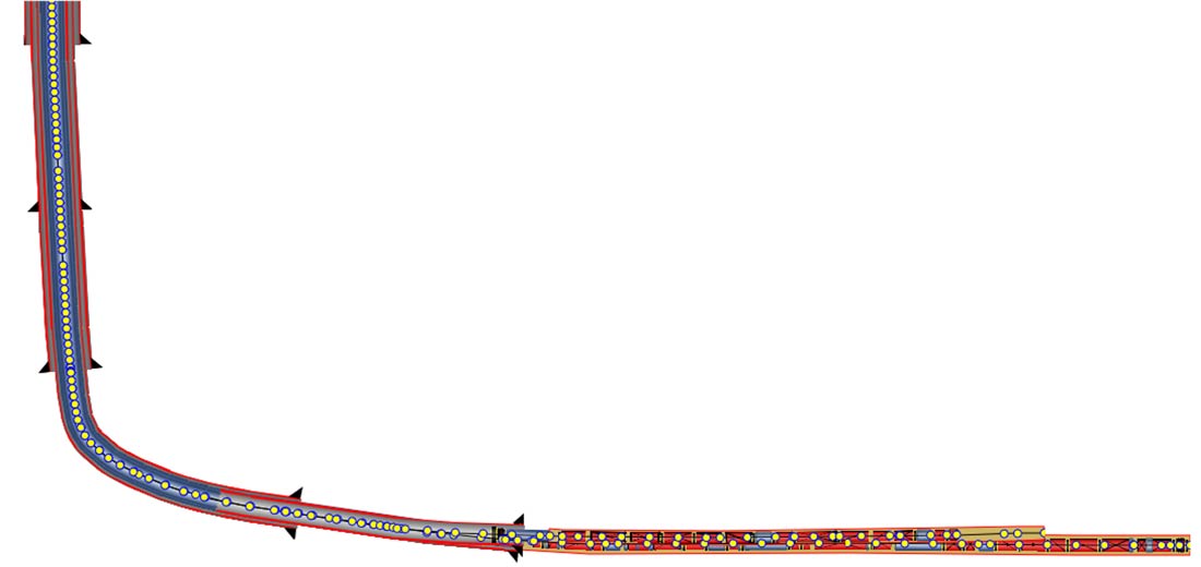
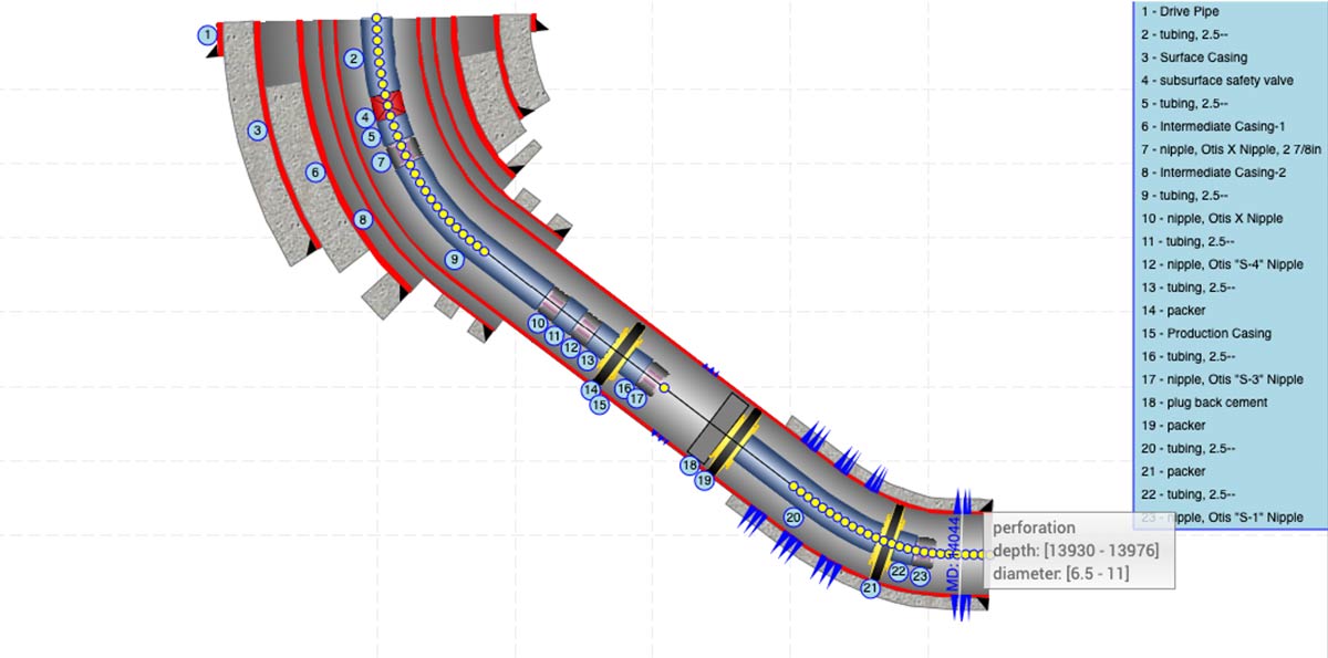
For the Schematic package, two new widgets have been introduced: Multilateral schematics and DeviatedSchematics widgets. There is now also support for units for WellSchematics for your data model and control for different labels and annotations based on components’ IDs that have been implemented.


CONTOUR

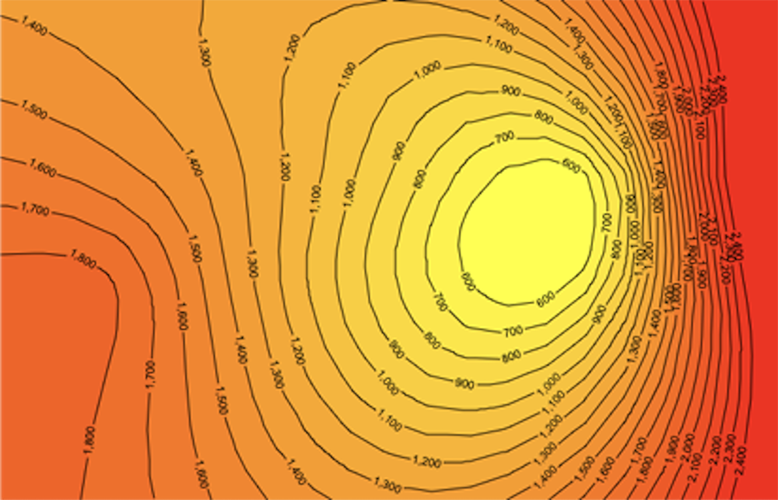
Gridding algorithms Kriging and ThinPlate have been added to Contour. GeoToolkit.JS can now display one isoline from contour and support multicolor isolines.


We are excited about the release of GeoToolkit.JS 2020 and would love to show you more about it. Contact us for a free trial at info@int.com.


Filed Under: GeoToolkit Tagged With: arcgis, deviated, es5, es6, geotoolkit, multilateral

Feb 15 2018

How to Add Overlay to Visualize Data from ArсGIS Feature Service

GeoToolkit.JS provides a set of libraries that display seismic, log, schematic, contour, real-time data, and more, and it includes a lightweight widget to display geographical data as layers from web map tile services (WMTS) like Google Map, OpenStreetMap, ESRI, MapQuest, and others and vector data from web map feature services (WFS).

WFS services can provide data in popular formats such as GeoJSON and ArcGIS ESRI Feature Layer format, KML. In this post, we consider how to display data, which includes geometry and nonspatial information like names, from ArcGIS ESRI services using the GeoToolkit.JS Map Widget and WMTS data from OpenStreetMap. The release of GeoToolkit.JS 2.5 is a good opportunity to tour basic map options.

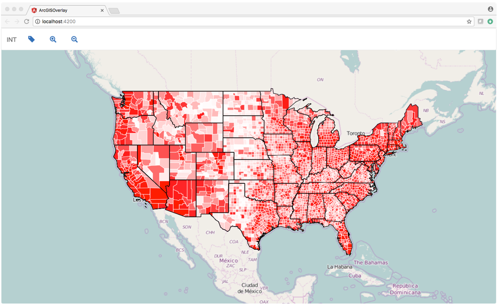
First, we need to have the latest version of the GeoToolkit.JS library in our system. We will use Angular framework and TypeScript to be more realistic to real-world web application. Also Angular CLI is used to simplify creation of this application. The following screenshot demonstrates a simple map application with three layers: WMTS with world map, ArcGIS Feature layer of states, and ArcGIS Feature layer of U.S. counties from public service.

Single map application

The full source code of this example can be found here on Github.

Let’s start writing application. If general initialization of Angular application is not relevant to you, then start with section 3.

Install the Necessary Software

This step can be skipped if you have Angular-cli and node.js on your computer.

Verify that you have node.js and npm in your system using the following command in console:

node -v

If installation does not exist, then go here and install the last LTS distribution.

The next step is to install the last version of Angular-cli in your system.

npm install -g @angular/cli

Create the Application

We start creation of the application using Angular-cli commands ng new

ng new ArgGISOverlay
cd ArgGISOverlay
ng serve

If it works, then create a folder called ArcGISOverlay\src\libs\geotoolkit and copy all files from the bin folder of GeoToolkit.JS installation.

Add a section in the .angular-cli.json file

“scripts”: [
“libs/geotoolkit/geotoolkit.adv.js”,
“libs/geotoolkit/geotoolkit.controls.adv.js”,
“libs/geotoolkit/geotoolkit.svg.adv.js”,
“libs/geotoolkit/geotoolkit.data.adv.js”,
“libs/geotoolkit/geotoolkit.pdf.adv.js”,
“libs/geotoolkit/geotoolkit.widgets.adv.js”,
“libs/geotoolkit/geotoolkit.map.adv.js”
],

Add a new component to display the map. Let’s call it OverlayComponent

ng g component overlay

Add CSS file to define application styles and add to styles.css

Add the following lines to app.component.html

<div class="content">
<app-overlay></app-overlay>
</div>

Add the following lines to overlay-component.html to specify HTML% canvas element to be used to render map. Parent div is used to control size of our map.

<div #parent class='plothost'>
 <canvas #map class='plot' oncontextmenu='return false'></canvas>
</div>

Add Layers

A map widget can support any number of layers. In our example, we add three layers.

The first is the WMTS layer which points to INT OpenStreetMap server.

return new geotoolkit.map.layers.WMTSLayer({
   'server': ['https://demo.int.com/osm_tiles/'],
   'minlod': 0,
   'maxlod': 19,
   'formatterfunction': function (z, x, y) {
     return z + '/' + y + '/' + x + '.png';
   }
 });

Second, add two ArcGIS overlays with data from the public URL of ArcGIS Feature Layer services. A layer initialization to load states looks like:

return new geotoolkit.map.layers.ArcGISFeatureLayer({
    'system': geotoolkit.map.GeodeticSystem.LatLon,
    'idfield': 'state_name',
    'server': service_url     
     });
};

It has three properties: the input coordinate system, unique field id, and server url. The second layer is similar.

If a source has a field, which defines a unique id of the feature, then it can be specified. This information can be found on page with service description. In our case, one layer has id, another doesn’t have it. If id is not specified, then artificial id is assigned for each feature.

In additional to geometry, each feature layer can provide nonspatial attributes. By default, layer loads all attributes for each feature. If you don’t need it, then you can declare them using property requestfields like this requestfields: [‘name’, ‘population]

In the next step, create a map widget and add three layers into it.

let map = new geotoolkit.map.Map({});
map.addLayer(this.createWMTSLayer());
map.addLayer(this.createCountiesLayer());
map.addLayer(this.createStatesLayer());

The last step is to initialize GeoToolkit.JS plot to render map layers on underlying HTML5 Canvas element, and the application is ready.

Customize the Feature Layer

In this section, we show how to change the graphical properties of the loaded Feature Layer. For example, we would like to color counties based on population. We just use one attribute of the counties layer “pop2000”, which represents a population of each county in 2000. A feature in ArcGISFeatureLayer can be rendered with shape template, which can be polygon, polyline, symbol, or any custom representation. For example, pie chart.

As a rule, it has only one instance of template for the sample type of features. In our case, we sort existing features by population and replace shape template, which is responsible for rendering particular features with custom shape with specified attributes. The result of this operation can be seen if you press the “Classify” button on the toolbar of this application. The source code looks like this:

this.countiesLayer.setTemplate(country, template);

We tell the application to use a new template for this feature instance. This application can be optimized if we group features by colors, but we will save that for a future post.

For more information about GeoToolkit, visit the GeoToolkit product page, or contact us for a free trial.


Filed Under: GeoToolkit Tagged With: arcgis, geotoolkit

Footer

Solutions

  • Real-Time Visualization
  • Visualization Components
  • New Energy Visualization
  • OSDU Visualization
  • Machine Learning
  • Developer Tools
  • Cloud Partners
  • Customer Success Stories

Products

  • IVAAP
  • GeoToolkit
  • INTViewer
  • IVAAP Demos
  • GeoToolkit Demos

About

  • News
  • Events
  • Careers
  • Management Team

Resources

  • Blog
  • FAQ

Support

  • JIRA
  • Developer Community

Contact

INT logo
© 1989–2024 Interactive Network Technologies, Inc.
Privacy Policy
  • Careers
  • Contact Us
  • Search

COPYRIGHT © 2025 INTERACTIVE NETWORK TECHNOLOGIES, Inc